 |
 |
Damn. Another late start. I woke up early enough, but I felt cold, and projected that feeling onto the weather. I watched the Weather Channel, as I tried to keep warm, and then channel surfed and ended up watching all of Powder. Sherri and David, my gracious hosts, woke up close to 11, and I was still there to say good bye to them. Sherri made a pot of coffee for me, and I took that opportunity to fill my thermos.
So, I start loading up my bike, and discover that it's much warmer outside. Not to mention gorgeous. Stupid me. My own fault if (when) I end up racing daylight today. That made me eager to hit the road, and by around noon, I start off.
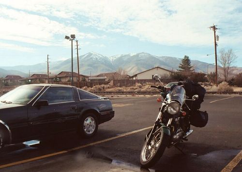
At least as far as the McDonald's for breakfast/lunch. It's a good thing fast food restaurants would be left behind here, or all my pictures would be of parking lots. Still, these are much prettier fast food parking lot backdrops than I'm used to.
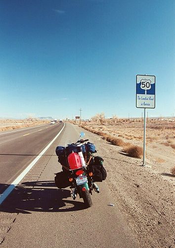 |
This day's agenda was to head to Ely, on Highway 50: America's Loneliest Highway.
I headed down Hwy 80 for about 30 miles to Fernley, to get on Hwy 50. The Loneliest Highway designation is displayed proudly, right off the bat, and I pulled in front of it to get a picture. The traffic seemed to disagree with the sentiment.
Straight from the Highway 50 Survival Guide Book provided by the Nevada Commission on
Tourism:
As a result, the highway was so named, and the tourism commission even provides "Highway 50 Survival Kits". I got mine at the end of my journey. It's cute, and in addition to information on sights and services along the route, you can get a passport stamped as you go to prove you travelled it (or in my case, all at the end in Ely). Sending it in will get you a certificate signed by the governor, and a bumper sticker. I made my way to Fallon, and stopped for gas and a Kragen. I noticed, when I installed my accessory socket on my bike, that my air intake hose to my gas tank was off. Someone off of the Triumph Bonneville Delphi Forum suggested getting a rubber coupler instead of forcing the hose back on (it's a very tight fit). I tried two or three Kragen's in the Bay Area without success, and this one was convenient, so hey. Anyways, the guy cut off a bit of fuel hose for me "No charge" to try, and it worked wonderfully. That was nice to finally have taken care of! |
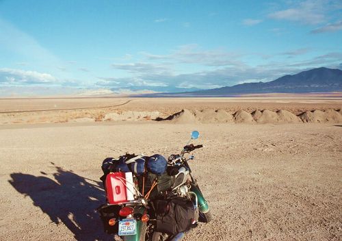
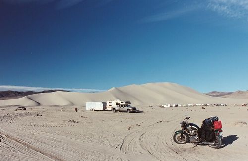
I stopped at Sand Mountain Recreational Area to check it out. It's a 600 foot high sand dune, and I'm sure alot of fun...with the right vehicle. My bike had enough trouble with the parking lot. Well, not really, but you do have to be careful. I'm still quite a ways from it in this picture; you have to look at the trailers in the distance to really appreciate its magnitude.
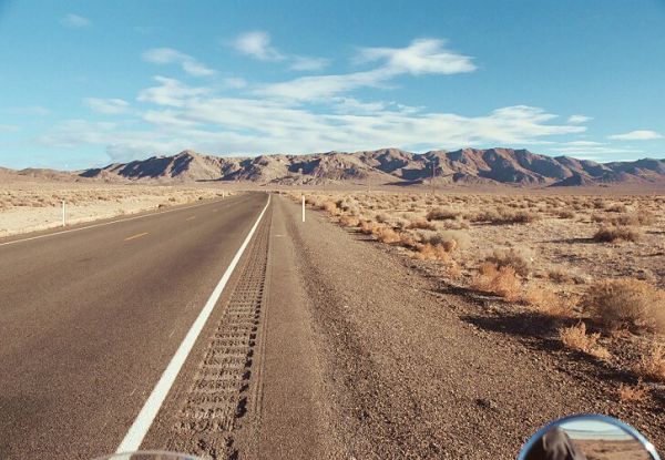
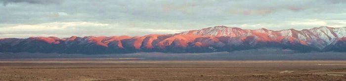
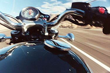
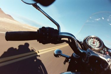
This is Highway 50. Long straight, healthy asphalt, with an amazing backdrop. The scenery is never tediously the same, and cars become more and more rare the deeper you go. Which means...it's time for some goofy fun. Mainly, trying to show what it's like to ride on my lap.
 |
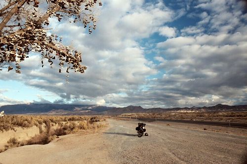
I almost missed the Shoe Tree, but its shape certainly sticks out as an oddity. I do a quick U-Turn to check it out. It's shoe tree season, since with its leaves fallen, the tree's unnatural fruit seems ready for harvest.
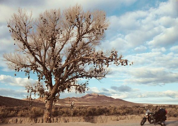
Funny how your mood changes how you view something. In my contemplative state, the Shoe Tree didn't seem goofy, or funny to me at all. Instead, I thought of all the faceless people who wanted to leave their mark here. This was a physical record of travellers who preceded me, and it was almost haunting to wonder about all those who felt compelled to leave a piece of their sole. I have since read an account by another motorcyclist who found it to be the most moving experience of his trip. And I think it was for me as well.
The story I hear most about the origin of the tree is that a pair of newlyweds (or soon to be married) were arguing and the husband pulled over (some say they were camping there). The bride said that she didn't want to go on, and would walk home, and in response the man said "Then you can walk home barefoot!", and tossed her shoes into the tree. He headed to a bar to cool off where the bartender convinced him to return for his bride. After reconciling, they found her shoes were too high up to be retrieved. A year later, they returned to toss their first baby's pair of shoes into the tree. The most "official sounding" story I've found, can be found here.
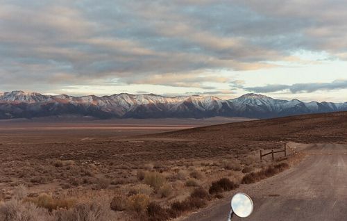
I remember what I was thinking when I stopped by the roadside to have some of the coffee, a Gatorade bar, and to take these pictures. "Stop dicking around, and make the most of what daylight you have left." Oh well. Instead I watched the sunset, and actually pondered setting up camp at this location.
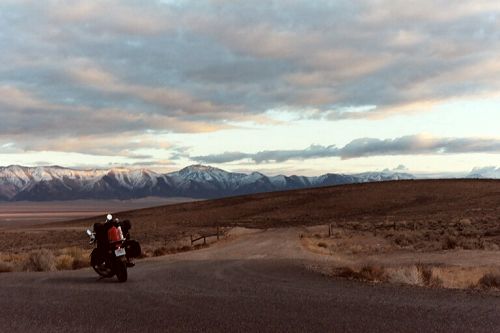
Yeah, but with the fading of the sun, I started to curse myself for giving in so easily to Sean Patrick Flannery. I made it to Austin just after sunset, and filled up with gas. One curious thing about Austin, is that it's a very small town (I think it has a population now of less than 200 people, but once was one of the largest cities in Nevada), but the street is lined with hotels! It was cold, and I plugged my jacket in there, and decided to try to press on to Eureka that night, if possible. I was about a hundred miles from Ely, so my day's destination wouldn't be reached. Oh well, maybe I'll make it to Vegas tomorrow night as planned anyways, if I can make an early start. Actually, I was ready to set up camp, and was hoping for an appropriate place to reveal itself some time soon.
Almost immediately out of Austin, the road became windy, and as fun as it might be, I was very cautious given the lack of light. It became apparent that I was climbing rather steeply. Soon, I was cresting Austin Summit, my highest point so far this journey: 7484 feet. One problem with riding at night besides the cold, and the safety, is that I'm missing all of the sights! I'm still curious how the twisty portion looked (or if it was even as twisty as it seemed). Oh well.
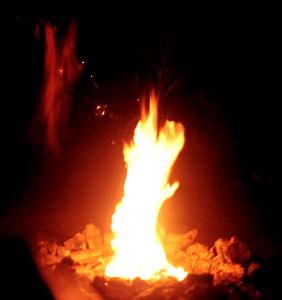
After maybe 30 miles, I passed a sign that indicated a campground, and did another U-turn. I pulled into a campsite, and noted that it came equipped with a picnic table, and a campfire spot. The sign at the entrance said no water, but since I was thinking of just pulling off the highway somewhere, I was prepared for that anyways. In fact, the campsite seemed quite luxurious with its amenities. I parked a fairly safe distance away from the campfire circle, and set up the tent by headlight. Since I expected it would be a cold night, I decided to forage for dead wood, and make a campfire. Hmmm. A gas can comes in handy. I fired up my one burner stove, and prepared a can of Progresso soup for dinner. Everything tastes fantastic while camping, and the coffee in the thermos was still hot. Thanks again, Sherri!
I don't think I've ever heard it so quiet before. Camping in my youth couldn't compare, because here, there was no drone of insects or the song of nocturnal birds in the background. Occassionally, I would hear a car along Highway 50, but they were pretty rare. And this was the only time I've had an entire campground to myself. Around eight 'o clock, I climbed into my sleeping bag for my first night of camping in about 7 years.
I woke up a few times during the night, and I think the first time was 10pm. I got up to hit the restroom, and stepped outside. For weeks before my trip, I would go into my backyard and look at the stars, wondering how they'd look in the middle of Nevada. Well, here they were. The clouds had disappeared, my campfire had subsided to softly glowing embers, and the heavens shone brighter than I've ever seen in my life. The constellation I look for most when I scan the sky is Orion, and I was amazed how noisy it was. Usually, it's well defined with its seven defining stars against a black background, but here I had to pick the outline out from the milky way. The stars were bright enough to cast shadows, and when I finally climbed back into my tent, I could still see them through the fabric. It's a shame that it was waaaay too cold to stargaze longer (or to bother getting out the camera).