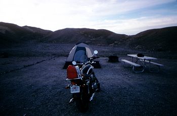
What a restful night! It's nice when you can sleep without trying to avoid contact with ambient air. It also takes less time to pack things up without waiting for everything to thaw, so I was ready for the road by 8:15. The campsite was $12, and a ranger came by as I was packing to collect (hey, I couldn't see the Iron Rangers, let alone the restroom when I pulled in).
I stopped off for breakfast in Furnace Creek Ranch, and toured the small town briefly. Pricey meal though, $7.50 for corn beef hash (see I told you I liked them) and eggs. And $3 for orange juice?! Eek.
I talked to the waitress about things I should do while I was in the park, and she also suggested a route to Bakersfield, as a fellow biker. Anyways, things on my list were definately Badwater and Artist Drive, so that's where I headed after getting expensive gas. (I'm not complaining about the cost of meals, gas, or anything in Death Valley though. It's just a fact, and I'm grateful that it's there).
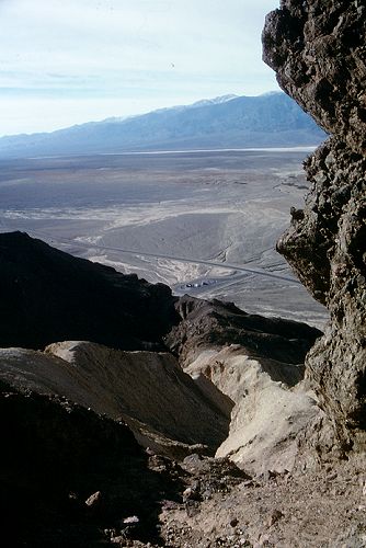
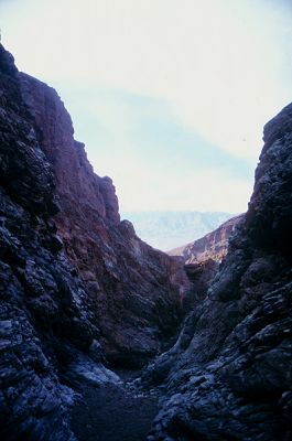
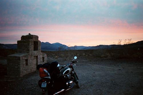
Along the way, I came across the trail head for Golden Canyon, and decided to go for a short hike. I notice a trail leading up the canyon walls, and decide to take it. My motorcycle boots aren't hiking boots, and it's still quite a climb. But I really like this shot back at my bike in the parking lot down below.
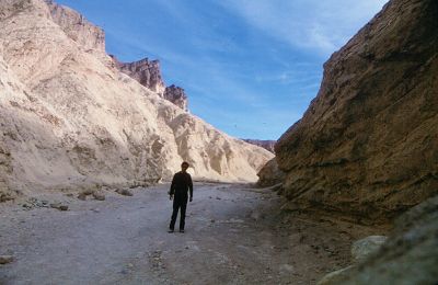
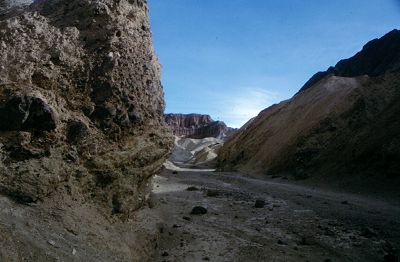
The remains of an asphalt pathway start off the hike. In 1976, it was destroyed in a flash flood! The walls of the canyon transition from rocky, to a smoother, golden hue.
I opted out of doing the full hike, for the sake of seeing what else there is to see, and headed down the road to Badwater. The weather was great, not uncomfortable in jeans, but certainly shorts could be in order if you wanted.
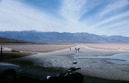
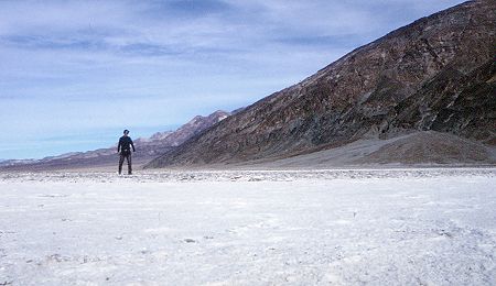
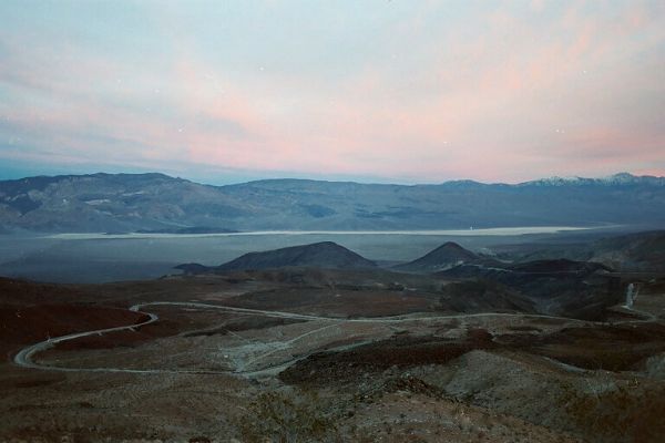
Badwater sits 282 feet below sea level. It's a huge valley of salt, with a small pool of water that's saltier than the sea. And is it ever a VALLEY. Right to the east is Dante's View, where I was the night before. And across to the West you can see Telescope Peak, powdered with snow at an elevation of 11,049 feet. On a clear day, you can see Mt Whitney, and view the lowest and highest point in the US from one location!
 Evidently, this is self portrait day | 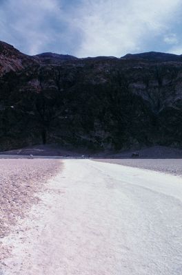 Looking back at Dante's View |
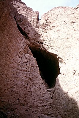
As I headed north again, towards Furnace Creek, I decided to hit the Natural Bridge. Wow, that is some rough road. Not just gravel, but rocky in parts My tires slipped around at times, and that was all white knuckle riding. And I get to do it twice. Visitors are becoming more frequent, and I wonder if there is truly an off-season for this park.
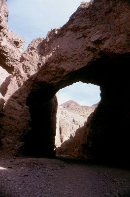
The Natural Bridge hike showcases many different types of rock formations. The bridge itself has been formed through erosion by flash floods. It has a span 46 feet. Glad there are no clouds in the sky. Other formations are described as "candle wax", "waterfalls", and "turtle-shell", and it's not hard to see why.
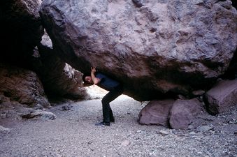
There are a couple of steep, slippery climbs on this hike. One even has a rope to aid in the scale (it's about 15 feet down, and all hard rock if you fall). I was rewarded with the opportunity to take a really cheesy self-portrait.
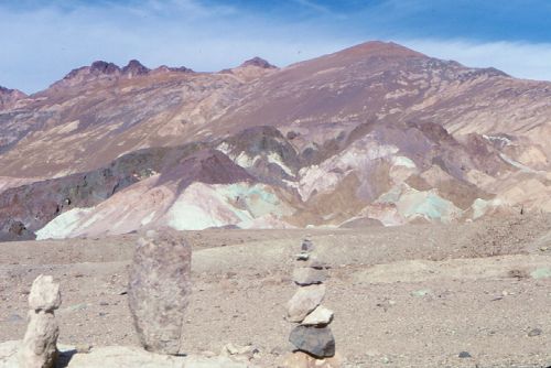
I take Artist's Drive on the way back. It's a fun, windy, one-way road with a wonderful back drop. One neat little thing people have been doing is erecting rock sculptures along the roadside. I didn't take a picture of my contribution, but certainly had to throw one into the mix.
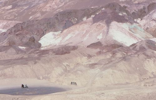
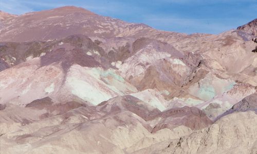
Along the way, there's a stop called Artist's Palette. All the colours of the Funeral Mountains are on display in a small location. Quite remarkable, and neat to see displayed like a palette!
By the way, I found my absolute favourite rock sculpture climbing the hill to take the picture of my bike at the parking lot of Artist's Palette. It stood there alone, in solitude, and my hat off to whoever created it! I wasn't quite that shutter-friendly at this point, because I was on my last roll of film, and using slide film to boot, so I didn't record it :(
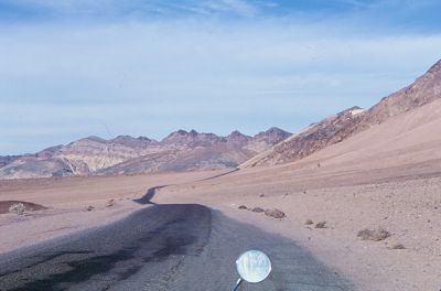
I gas up (and get water, and film, but they only had 200 speed at the gift shop) at Furnace Creek for good measure and head north again on 190. You know the roads of Death Valley are fun, although you shouldn't do them like a speed demon.
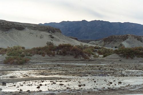
I stopped off at Dry Creek, where a boardwalk leads you on a nature hike. Some times you can find the rare Death Valley pupfish in the brakish water, but they were all hiding this day. I did see a lot of fire ants! It was neat to see a water environment in the desert with greenery, sandy shores, and mountains in the background!
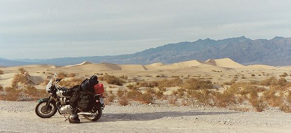
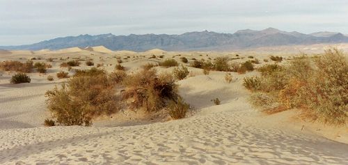
The Sand Dunes near Stovepipe Wells really brought home that this was the desert. Piers tells me it was way too hot to walk on the sand when he visited, so I'm thinking other than the pup fish, winter is probably a good time to come here.
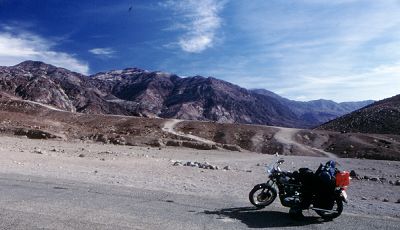
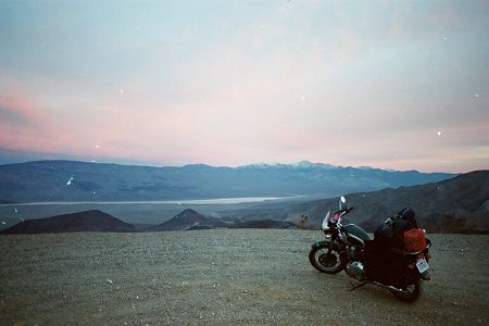
I stopped off at the Ranger Station for my entrance pass, as I prepare to leave the park. Hey, a cool thing about touring Death Valley on a motorcycle; it's only $5, vs $10 for a cage! I decide to take the simpler route towards Bakersfield, instead of the more agressive Emigrant Canyon Road, due to racing daylight again (sigh). I climb in altitude as the sun goes down, and it starts to get cold again. I stop off for some beef jerky, and gas in Panamint Springs, a really small town in the mountain range. The most expensive gas ever! ($2.32 a gallon). As I continue along the windy canyon roads, I leave Death Valley at Father Crowley's Point. I'm scared of heights, and this road was the rockiest, slipperiest I've ever been on on my bike. I mean, sometimes my rear tire had nothing but boulder to cling onto. But well worth it. Unfortunately, Kodak screwed up my negatives so the pictures ...are messed up. I was a bit too late too, just as I pulled up on my bike, the sun's rays bathed just Telescope Peak in it's rosy rays. It's here, I bid farewell to Death Valley, but my day was still far from over.
Carving the mountain roads at night is not nearly as fun. I'm ashamed to admit cars passed me. I was still like 70 miles from Olancha, and a long ways off from Bakersfield. By the time I make it to Olancha it is almost completely dark, and I can only barely see 10000+ ft mountain range to my immediate west. I wonder what that stretch of road beside the Sierra Nevada looks like! I stopped at a gas station to put my cold weather gear on, and hope it's not like this all the way to Bakersfield. I shoot down 395 towards Mohave, which is still 90 miles away.
I passed through Red Rock Canyon Park, with friendly campfires glowing well off in the distance, and pondered staying there for the night. But the longer I push this day, the sooner I get to see Kayley the next, so I push onwards. I passed briefly through the Mohave Desert, without knowing what it looked like either. Oh well, at least it's warmer. After fueling up in California City, where it does feel like California (loud rap anyone?), I take highway 58 to Bakersfield. It begins to get foggy, and smelly as I pass through industrial sections, and I stop at a Jack in the Box, in a dodgey looking part of town for dinner. I picked Allensworth State park to stop for the night, another 40 miles north on Highway 99. I don't know if it was all those dirt roads of the day, but as I pulled of highway 99 to take highway 46, my headlight goes. I stopped on the side of the road and pondered briefly whether to replace it then and there. Instead, I pointed my headlight down, and pressed on.
After a seemingly long period of time in the fog and darkness, with oncoming trucks as the only thing breaking up the journey, I pulled into Allensworth State Park. It was rather spooky looking, with it's half-constructed buildings, and other buildings needing repairs. No other campers, there was only a pickup truck to be seen, and I thought of serial killers with a penchant for British motorcycles. I quickly got my tent up, and crawled into the sleeping bag, my trusty Mag-Lite at my side. This was a good example of all you cram into a day's worth of vacation at least.